tearing paper, kibbutzing
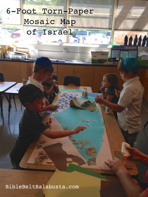
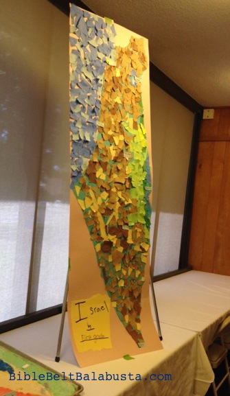
First Grade needed an “Israel project” for Yom Ha’atzmaut this year, and as usual, it had to fit into a 30 minute class period. So, we made a six-foot torn-paper mosaic map of Israel. The map was a busy, hands-on work to introduce—in a nutshell—the shape, location, major cities, topography and neighbors of the state of Israel.
Honestly, we didn’t have time for many details, but I wanted them to get a hands-on intro to the country as a physical place. We talked about the ancient Land of Israel and the very young State of Israel as we tore, glued and labelled.
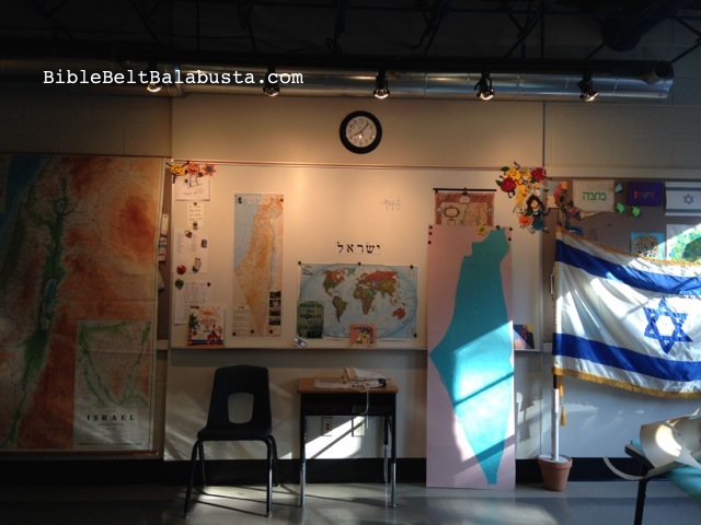
That same day, the giant map helped decorate our school’s Yom Ha’atzmaut program, along with the Salt Dough Map of Israel made by two other art classes.
I’ll bring out this map next year when the makers are in Second Grade, so they can build on their own work and feel a bit of ownership. We’ll figure out a way to modify and re-use.
HOW: Before class, I cut an outline of Israel from a 36″ roll of paper and glued it to two standard sheets of poster board placed end to end. (I rather wish my Israel hadn’t been blue, but blue was all I had. Students got a little confused about what was water and what was land.) Better, of course, is if the kids make the outline, cut and mount (see note below).
During class, we compared the shape with maps on the wall and on tables, and noticed bodies of water, cities and topography. Kids tore scrap paper into bits and glued them to represent water (blues), desert (browns) and mountains (greens). Sign-makers made a checklist of cities and then made labels out of scrap card stock to add the finished collage. Yerushalyim shel zahav—Jerusalem, City of Gold—got a glittery paper star.
maps for reference
Note: I’d love to use a projector to project a map onto huge paper and let the kids trace the outline, cut and mount. If we do this again, I’ll schedule two classes to make time.
Another idea is to make the torn papers thematic, somehow: images from repurposed calendars, Judaica catalogs, Jewish education catalogs, maps, tourism brochures, and so on. A wide variety would give kids visual clues that Israel is full of different types of people, plants, food, industries, etc. etc. To preserve color-coded topography, kids would need to tear and then sort into basic color groups before gluing.


Another great idea! 🙂